Yvonne van Mil, Mila Avellar Montezuma, Marlies Augustijn, Beate Begon, Jean-Paul Corten, Fangfei Schutte-Liu, Matteo D’Agostino, Paolo De Martino, Mattia De Lotto, Carola Hein, John Hanna, Lukas Höller, Elena Marie Ensenado, Lea Kayrouz, Alankrita Sarkar, and Francesca Savoldi
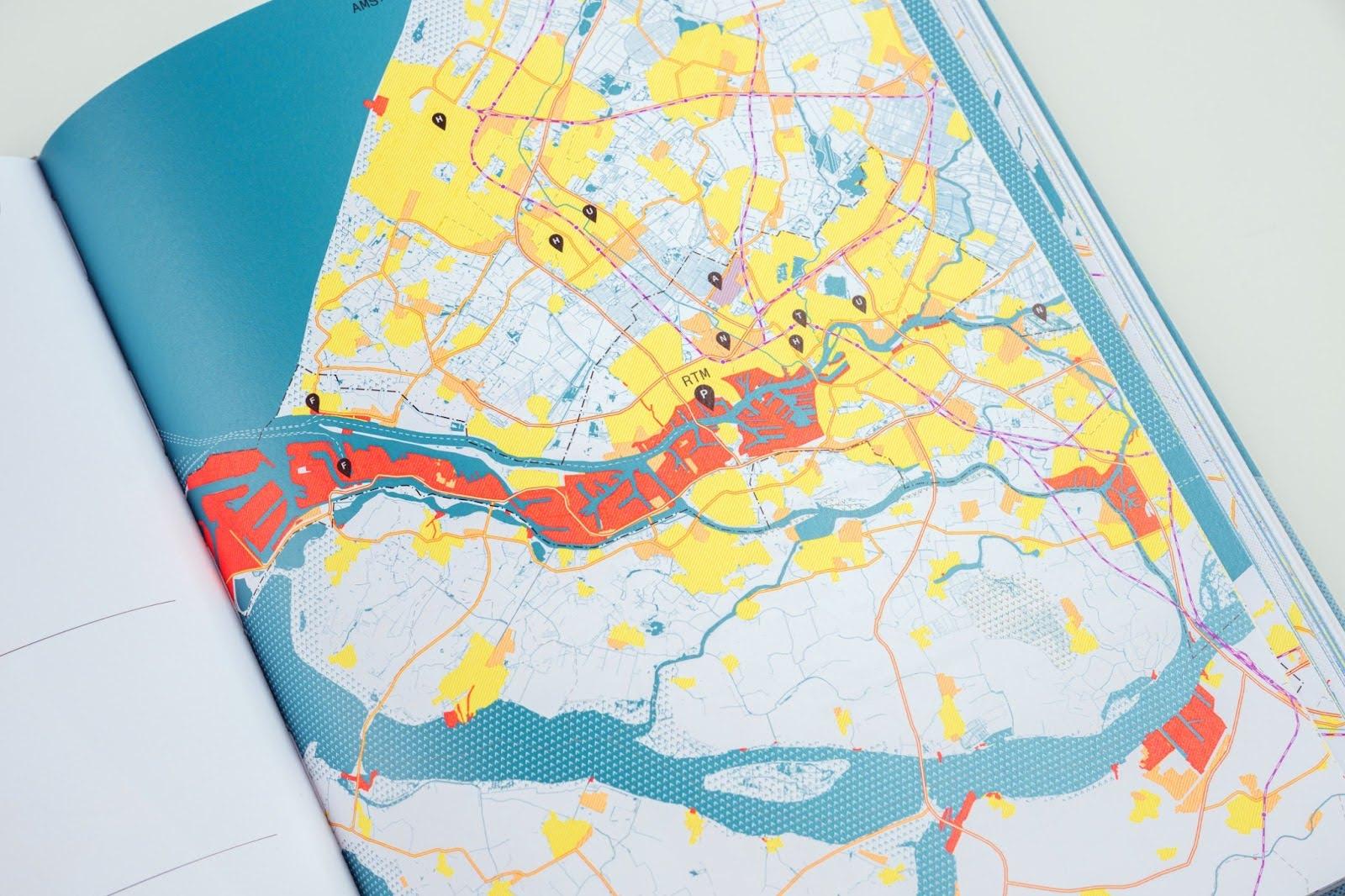
Large ports such as Rotterdam, Shanghai, or Los Angeles are always in the foreground; they are in the press, the subject of many academic studies, and key players in political decision-making, but what about all small and medium-sized ports in the same territory? If we look at the map of the port city territory of Rotterdam (Hein et al., 2023), we see several red spots indicating the ports of Scheveningen, Schiedam, Dordrecht, and Moerdijk, among others. These ports facilitate access to water and land, effectively support local industries, connect communities, and cooperate with larger maritime hubs (Figure 1). Together, these small ports form an important spatial, social, and economic grouping that is under-researched (Carella et al., 2024) and in need of comprehensive planning and policy advice. This blog presents different perspectives on the challenges and opportunities of small ports by presenting five ongoing projects by PortCityFutures members that address key issues in small ports. These projects were presented during the poster presentation at the symposium (RE-) CONNECTING MARITIME-URBAN ECOSYSTEMS on 16-17 September, 2024.
In today's rapidly changing landscape and at a time of rising sea levels, port city territories or other water-bound areas face complex challenges—balancing security, sustainability, and economic development. Addressing these issues requires a comprehensive and inclusive approach that values the insights and innovations of smaller port communities in building a resilient and sustainable future. However, the important role of smaller ports is often overlooked (Carella et al., 2024). Small ports are located along coastlines, rivers, lakes, or other bodies of water, and generally operate with smaller vessels and limited capacity, handling less than 10 million tonnes of goods annually (Bernacki & Lis, 2021). They tend to have a smaller physical size and footprint, less extensive infrastructure, and fewer facilities than larger ports.
Small ports can be defined not only by their volume of cargo handled, but also in relation to other ports within the same ecosystem, territory, or network. Smaller ports can play a crucial role in the resilience of the territory, contributing to economic, social, and environmental sustainability. Unlike large ports, which are often resistant to change, smaller ports such as Scheveningen, Schiedam, and Nijmegen offer opportunities for experimentation and innovation. Their deep-rooted links to the local maritime heritage make them ideal places to test new ideas, foster collaboration, and build a resilient future. In addition, these ports need targeted policies, planning, and support to meet contemporary challenges and maintain their position or even survival, especially in terms of long-term development and their relationship with the regional or territorial context.
Small coastal ports along the North Sea
The Living with Water project underscores the importance of small ports in the Dutch Delta, showing how studying these adaptable hubs can drive structural, cultural, and environmental changes across the region, especially in more complex ports like Rotterdam. By focusing on small coastal ports, the project aligns with broader strategic themes explored by the NXR-2024 Designing for Extremes initiative, where port resilience and heritage strategies are at the forefront of adapting to climate challenges. Both projects converge on the critical goal of preparing Dutch coastal cities to withstand rising sea levels through innovative strategies that blend cultural heritage with traditional-contemporary-innovative adaptation measures. This holistic approach not only alleviates pressures on larger port hubs but also strengthens the connection between communities, ports, and the urban-maritime territories that surround them, forming a roadmap for future resilient port-city relations and contributing insights toward global adaptation strategies and public policies.
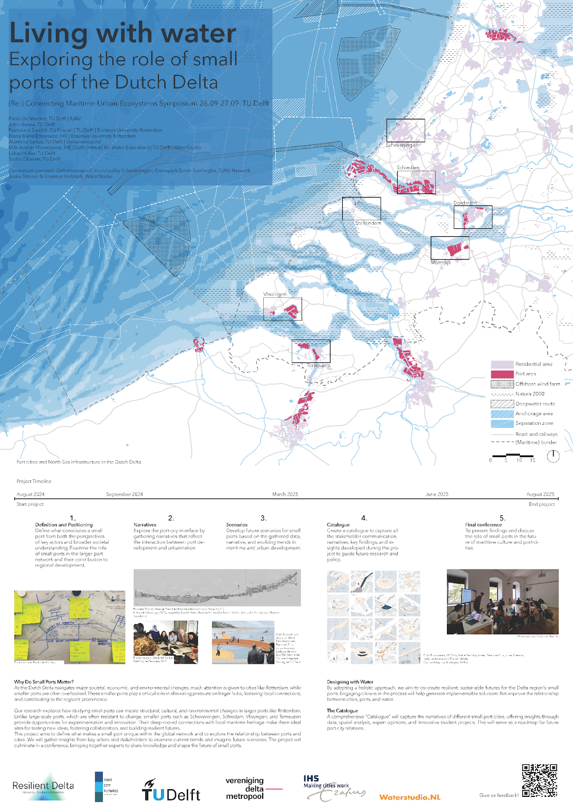
Living with water: Exploring the role of small ports of the Dutch Delta (figure 2) explores how studying small ports can inspire structural, cultural, and environmental changes in larger ports like Rotterdam. The Dutch Delta, known for its innovative water management and maritime infrastructure, faces increasing challenges due to climate change, urbanization, and evolving economic demands (Meyer, 2012). The project aims to define what makes a small port unique within the global network and to explore the relationship between ports and cities. It will gather insights from key actors and stakeholders to examine current trends and imagine future scenarios, which will culminate in a conference, bringing together experts to share knowledge and shape the future of small ports. By adopting a holistic approach, it aims to co-create resilient, sustainable futures for the Delta region’s small ports. Engaging citizens in the process will help generate implementable solutions that improve the relationship between cities, ports, and water. A comprehensive “Catalog of best practices” will capture the narratives of different small port cities, offering insights through data, spatial analysis, expert opinions, and innovative student projects. This will serve as a roadmap for future port-city relations.
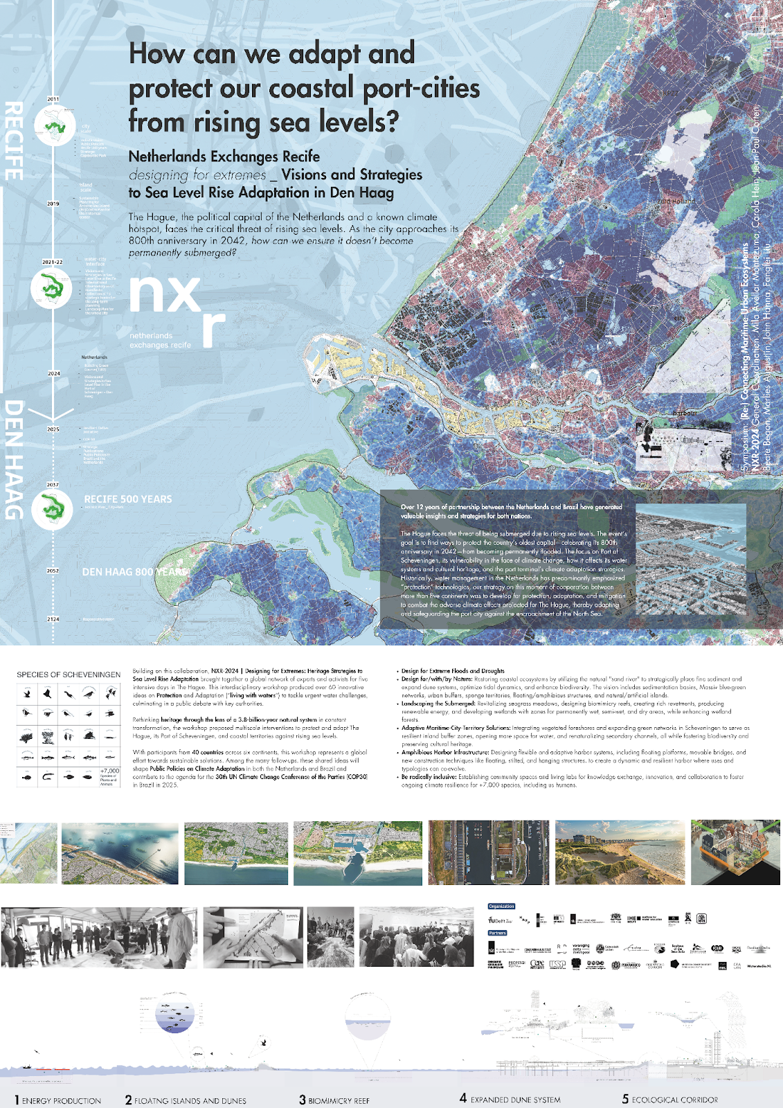
The Netherlands Exchanges Recife NXR-2024 Designing for Extremes: Heritage Strategies to Sea Level Rise Adaptation (figure 3) project raised the question of how we can adapt and protect our coastal port cities from rising sea levels. The Hague, the political capital of the Netherlands and a known climate hotspot, is threatened by rising sea levels. The project initiated an event with the aim of finding ways to protect the capital from permanent flooding. The focus is on the port city of Scheveningen, its vulnerability to climate change, the impact on its water systems and cultural heritage, and the port terminal's climate adaptation strategies. Historically, water management in the Netherlands has mainly emphasized “protection” technologies; at this moment of cooperation between more than five continents, our strategy was to develop protection, adaptation, and mitigation to combat the adverse climate impacts projected for The Hague, thereby adapting and securing the port city against the encroachment of the North Sea. NXR-2024 builds on a 12-year partnership between the Netherlands and Brazil that has generated valuable insights and strategies for both countries. It brought together a global network of experts and activists for five intensive days in The Hague. This interdisciplinary workshop generated more than 60 innovative ideas on protection and adaptation (“living with waters”) to address pressing water challenges, culminating in a public debate with key authorities. Rethinking heritage through the lens of a 3.8 billion-year-old natural system in constant flux, the workshop proposed multi-scale interventions to protect and adapt The Hague, its port of Scheveningen, and coastal areas against rising sea levels. Among many follow-up activities, these shared ideas will shape public policies on climate adaptation in both the Netherlands and Brazil and contribute to the agenda of the 30th UN Conference of the Parties (COP30) in Brazil in 2025.
Small European port cities as part of river networks
Academic research has largely focused on maritime seaports (Bird, 1963; Hein, 2011; Hein, 2023), while river and inland ports have received comparatively little attention. This research gap reflects the general academic neglect of small and medium-sized ports, as most European river ports fall into these categories. Despite their size, river ports are essential as they serve as key hubs connecting large and small coastal ports to waterborne hinterland networks. Inland ports, in turn, rely on their strategic location within networks linking major coastal ports or urban centers. For example, Nijmegen is the largest inland port in the Netherlands and benefits from its location on the Rotterdam-Ruhr link. The next three projects deal with these river or inland ports, all from a different perspective and at various scale levels. They focus on ports as well as the surrounding cities, which might be large (such as Paris and Cologne) as well as small settlements (such as Dordrecht or Nijmegen). The study on river port cities examines the relationship between European ports within river networks and between the port, the city, and the surrounding landscape to better understand the complexity of these territories within their catchment areas. This research is part of a comparative study entitled River Port City Atlas, which will culminate in the publication of an atlas exploring the spatial challenges and potentials of river port city territories in Europe. The PhD project From Healthy Cities to Territories of Wellbeing examines the small and medium-sized river port cities in the Rhine basin as a subject for research on regional health and well-being. While the Navigating Challenges project zooms in on the case study of Nijmegen and the use of the river by the local community. All three projects show that everything is connected, from water safety and sustainability to economic interests and social concerns.
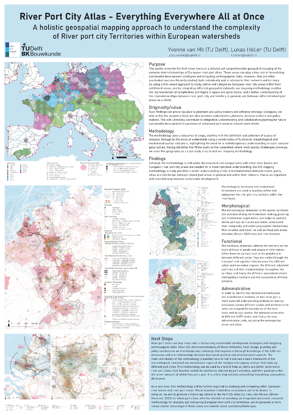
The poster of the forthcoming River Port City Atlas (figure 4) presents a holistic geospatial mapping approach to understand the complexity of river port city territories within European river basins. Similar to smaller coastal ports, river ports can play a key role in sustainable development, with opportunities to address water-related risks and contribute to the Sustainable Development Goals. However, they are often overlooked and understudied, especially in relation to their territory and water network. Given the interconnectedness of these areas through water systems, their design, planning, and policy have become an interdisciplinary challenge that requires a thorough knowledge of the different processes and interrelationships between functional, political, and environmental aspects. The proposed new GIS-based mapping methodology addresses these medium or small river port areas by providing a framework for analyzing the overlapping arenas—morphological, functional, and institutional—that shape port city territories. By integrating geospatial datasets, it serves as a tool to better understand the complex relationships between river, port, city and territory, and the role of river port cities within their territories and water networks, supporting a holistic view of their operations and impacts. This provides valuable insights for planners and policy makers and fosters strategic dialogue between academia and government to improve collaborative planning for sustainable urban development in shared river basins. Having tested the methodology for the Rhine basin, which has provided insight into the different categories of river port city territories and the logic of their position in the network, future research will extend this approach by studying other European river basins and port areas, with the aim of producing a follow-up volume to the Port City Atlas (Hein et al., 2023). This further research will refine the methodology and contribute to a more comprehensive understanding of European river port cities, identifying key challenges and questions for future research.
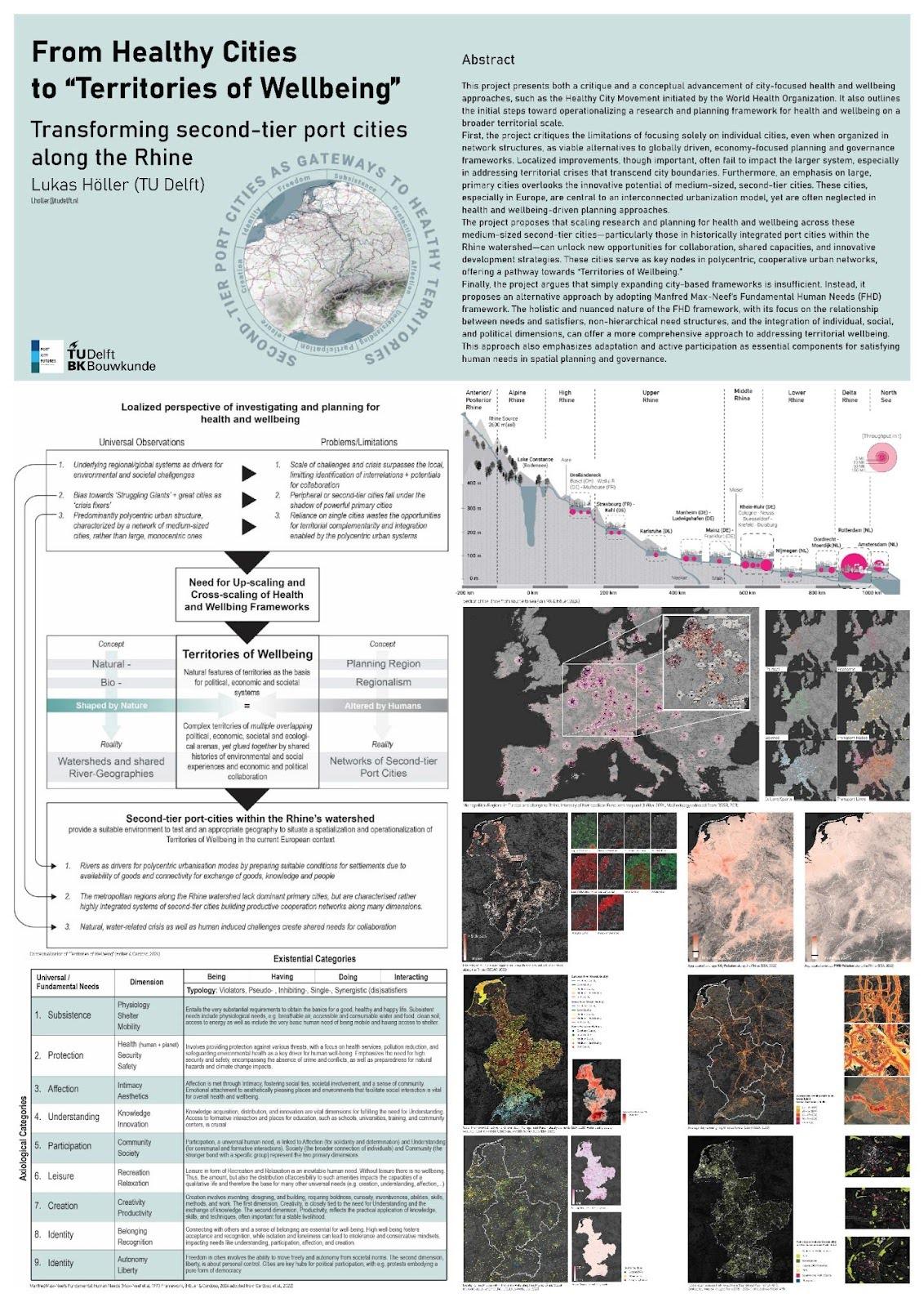
The Project “From Healthy Cities to Territories of Wellbeing: Transforming second-tier port cities along the Rhine” (figure 5) focuses on small and medium-sized river port cities along the Rhine and sees them vital to research regional health and wellbeing, as they form a unique polycentric network rooted in historical merchant trade and economic independence from national or monarchical forces and interdependence between each other. Today, facing shared challenges like flooding, drought, and industrial pollution, these cities can benefit from collaborative approaches, as seen in initiatives like the International Commission for the Protection of the Rhine. Yet, expanding these corporations beyond current environmental and economic management activities could foster even better and more territorial-based integrated planning for health and wellbeing across scales and borders, leveraging the region's adaptive capacities and historical interconnectedness through small and medium-sized river port cities.
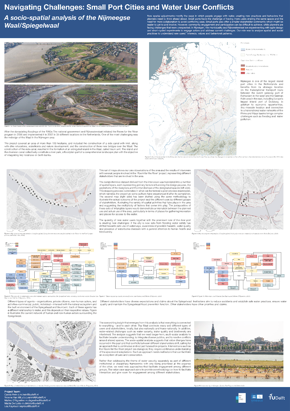
The project Navigating Challenges: Small Port Cities and Water User Conflicts (figure 6) reflects on the socio-spatial analysis of the Nijmegen Waal/Spiegelwaal. It shows that urban small ports continue to play an essential role in the city economy while clashing with communities’ changing needs and requests for leisure and public spaces. To meet increased demands for water safety, port authorities, city planners, and different government bodies need to work with local communities to avoid conflict and address how residents inhabit newly created spaces. In response to the devastating floods of the 1990s, the Dutch government launched the “Room for the River” program in the early 2000s, with 34 sites implemented between 2007 and 2015. A key project was the redevelopment of the River Waal near the city of Nijmegen, which included the creation of a side channel (the Spiegelwaal) and an island (Veur-Lent), the relocation of dikes, the development of waterfronts, and the construction of three new bridges. These newly created spaces have made Nijmegen internationally popular and are a source of pride for many Nijmegeners. At the same time, local residents and tourists began to inhabit the river park and its bridges in unexpected ways, creating alarm in public authorities concerning water safety. The number of new water users engaging in a variety of leisure activities vastly exceeds what was planned and are taking over spaces on the river Waal that are primarily used for industrial shipping and recreational cruising. This created a number of potential hazards, ranging from swimming in polluted waters to the danger of drowning and boating accidents.
The project developed as a multidisciplinary effort to assist municipal and Rijkswaterstaat employees in pursuing a better understanding of different stakeholders’ choices, changing preferences, and values to raise awareness towards a safe shared use of the Waal and the Spiegelwaal. In line with the value case approach (D’Agostino & Hein, 2024) developed through the creation of the professional education course Water System Design, the team engaged in three levels of analysis: historical, spatial, and social. The combination of the three levels carried out through a mixed method approach that integrated ethnography with analytical mapping generated valuable insights regarding changing definitions and perceptions of water safety both from the governance and the residents' perspectives, uncovering implicit values guiding the different stakeholders’ choices and actions in their socio-spatial practices. This resulted in design proposals and policy recommendations hinting at a long-term, multi-scale approach to better integrate diverse publics and resolve conflicts, arguing that ongoing and multisectorial engagements, rather than a project-based approach, are needed to address changing values and stakeholder dynamics.
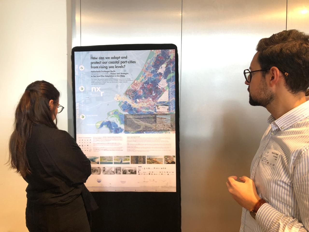
Taken together, these projects illustrate the urgency of small ports and, in their own way, explore their potential and challenges and contribute to putting small ports on the agenda as one of the research themes of PortCityFutures. The posters attracted a lot of attention and stimulated interesting conversations (figure 7).
Acknowledgments
This blog post has been written in the context of discussions in the LDE PortCityFutures research community. It reflects the evolving thoughts of the authors and expresses the discussions between researchers on the socio-economic, spatial and cultural questions surrounding port city relationships. This blog was edited by the PortCityFutures editorial team: Wenjun Feng. In particular, we thank Carola Hein for her valuable input and comments.
References
Bernacki, D., & Lis, C. (2021). Forecasting the cargo throughput for small and medium-sized ports: Multi-stage approach with reference to the multi-port system. European Research Studies Journal, 24(3), 208–228.https://doi.org/10.35808/ersj/2350
Bird, J. (1963). The Major Seaports of the United Kingdom. London: Hutchinson.
D’Agostino M., & Hein C. (2024). “Design-Based Solutions for Water Challenges: The Value Case Approach”. Blue Papers 3 (1). https://doi.org/10.58981/bluepapers.2024.1.06
Carella F, De Martino P, Soffietti F, Negretto V, Musco F .(2024). The Spatial and Governance Dilemma of Small and Medium-Sized Italian Ports (SMPs): Maritime Spatial Planning (MSP) as a Potential Response. Water, 16(2), 251. https://doi.org/10.3390/w16020251
Hein, C. (Ed.). (2011). Port Cities: Dynamic Landscapes and Global Networks. 1st ed. London: Routledge.
Hein C., van Mil, Y. & Ažman-Momirski, L. (2023). Port City Atlas. Mapping Port City Territories: from Understanding to Design, Rotterdam: Nai010. https://doi.org/10.59490/mg.73
Meyer, H., Nillesen, A. L., & Zonneveld, W. (2012). Rotterdam: A City and a Mainport on the Edge of a Delta. European Planning Studies, 20(1), 71–94. https://doi.org/10.1080/09654313.2011.638498
van de Ven Frans H. M. , Zevenbergen Chris , Avellar Montezuma Mila , Ding Zihang , Veerbeek William , Chen Shiyang (2024). The Three-Points Sponge Policy approach; toward an enhanced multi-level resilience strategy. Frontiers in Water, DOI=10.3389/frwa.2024.1361058.
NXR: Designing for Extremes: Sea Level Rise Adaptation in the Hague-Netherlands https://recifeexchanges.com/netherlands/
